Wow…Day 3 and it feels as though we have been travelling for more. Despite the fact that we are not even hitting 400 kms each day, we have been exhausted by the time we arrive at the hotels at the end of the day. Today was a bit better even with the 33 degree temps (and higher at times) in the later part of the day.

Before we departed Goldendale, Washington this morning we were treated to one more glance at Mount St. Helen….well it wasn’t actually the last one but it was the last photo. Stopping on the side of the road in some areas is difficult as there is no shoulder. Sometimes we can find a spot but honestly, I can take a picture and I can post it here but you just have to understand that it is not in anyway close to what you see in person. Firstly it is bigger, it just is. Secondly, unless you have a camera with a lens designed to take these photos (which I didn’t bring), the photo is just a far away shot much like one you would take of the moon. Ms Helen showed herself as we left Goldendale including being at the end of the street for about a 4 km stretch. I never get tired of looking at the mountains….or riding them…so back to our departure.
We left Goldendale taking the 142 heading towards Oregon. The Road Atlas indicated it was a scenic route…what it didn’t indicate was the elevations and the turns. Again Washington treated us to steep drops and switchbacks into a deep deep valley just like we found yesterday. At times we were riding along rock faces, dropping into pines and then back into meadows high above us on the rocks…it just kept changing and creating a backdrop worthy of any documentary or movie. We came down into a valley canyon to a small village of Klickitat (say that three times). We lifted our visors and took in the smell of the forest and pines and the river. We followed the Klickitat River for quite sometime. It appears to be a glacial river with many creeks spilling into it. The colour, a sweet sage, and the rapids were quick.

From the rest stop we could see Oregon and the highway that runs along it. The Columbia River actually runs along more than 60% of the border between Oregon and Washington. As I mentioned before, Washington at times has reminded us of the Grand Canyon and Arizona…if you look at the rock formations, the river runs through what are like canyons similar to the Colorado River which runs through the Grand Canyon….rock cut by glacier melt.

This bridge is a draw bridge and spans 1.4 kms across the Columbia River. It was built in 1924. We didn’t get a picture of the bridge but we did manage to get a “Welcome to Oregon” and special instructions for motorcyclists…helmets are a thing here which is good…we wear ours all the time.
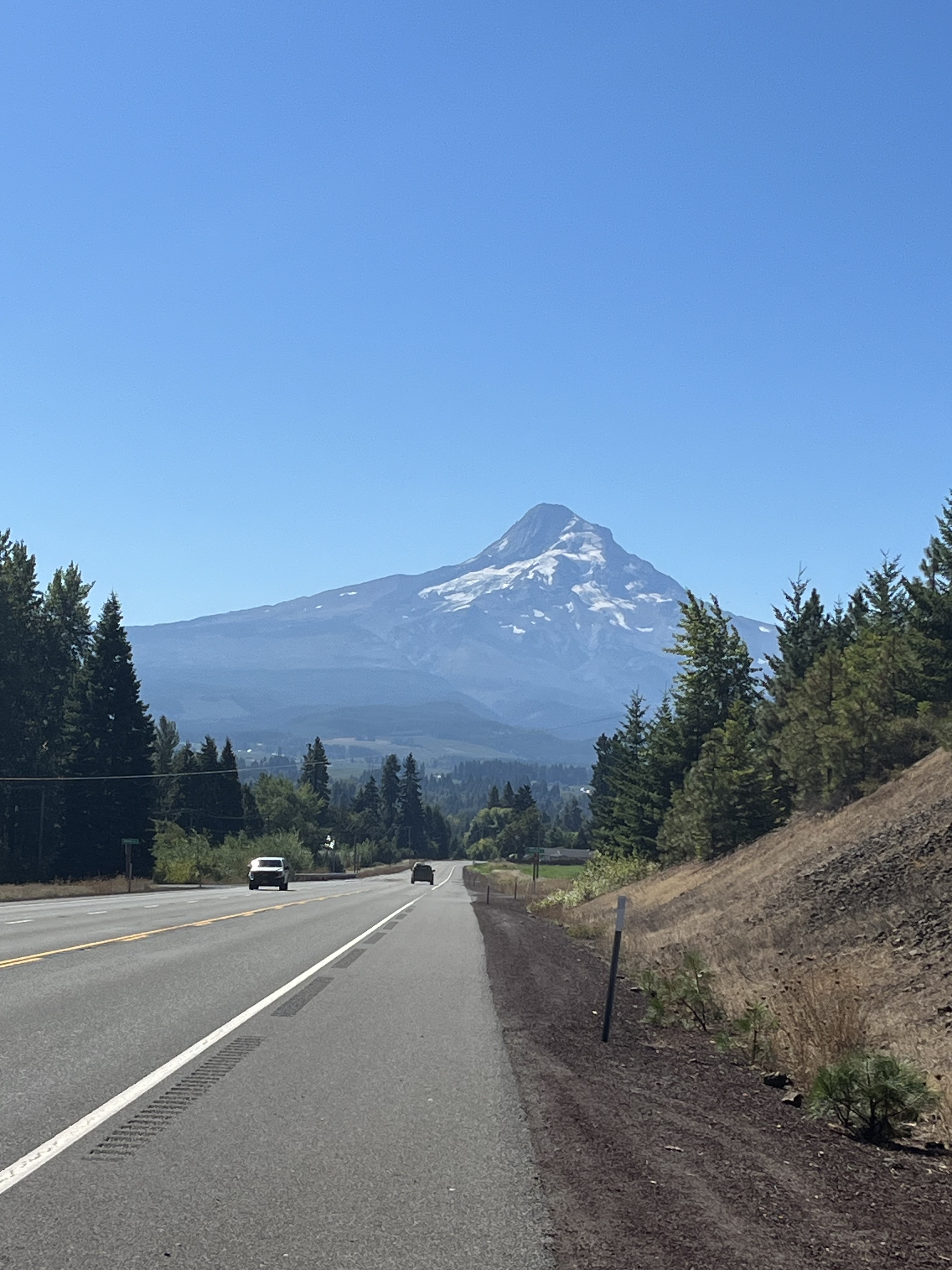

Although the road was a beautiful vantage point to see the mountain, we did manage to find a park where we could stop. This offered the best view of Mount Hood. We were also closer to the mountain so it was easier to get a bigger than life photo (or at least the biggest one you can take with an iPhone). If you look closely at the two pictures it would almost seem as though you are looking at two different mountains. In fact, you are just looking at different sides of the same mountain. We were in awe. We took our time at this stop to take in the site. I would dare say, despite all the fabulous roads, this was a high-light of our day. After the park we stopped at Government Camp for fuel and then down into the village for lunch at the Huckleberry Inn for a bowl of homemade chili.


No comments:
Post a Comment